2016 Changes
This page provides a summary of the flight path and airspace changes we implemented in 2016.
To learn more about each change click on the title of the change below or access the document library on the right.
For questions about the below changes and/or matters relating to current aircraft operations, please contact our Noise Complaints and Information Service (NCIS).
This page provides a summary of the flight path and airspace changes we implemented in 2016.
-
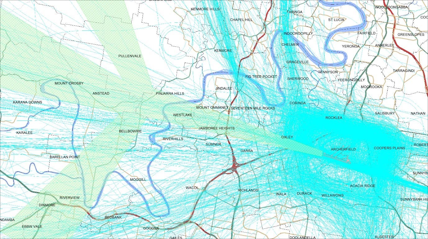
Archerfield Airport
In accordance with the Civil Aviation Safety Authority (CASA) mandate that all aircraft operating under Instrument Flight Rules (IFR) are required to navigate primarily using satellite-based means and to ensure we continue to have the safest and most efficient air traffic management system possible, Airservices is re-designing arrival flight paths at some airports for aircraft flying on instrument flight rules.
According to recent ICAO and CASA requirements, the last few nautical miles of all final approaches to runways, including satellite based approaches, must be in a straight line with the runway to ensure the highest level of safety isContinue reading
This page provides a summary of the flight path and airspace changes we implemented in 2016.
-
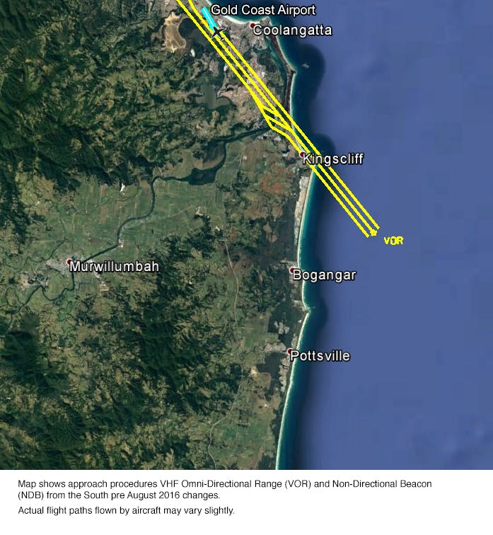
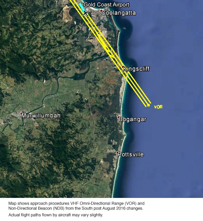
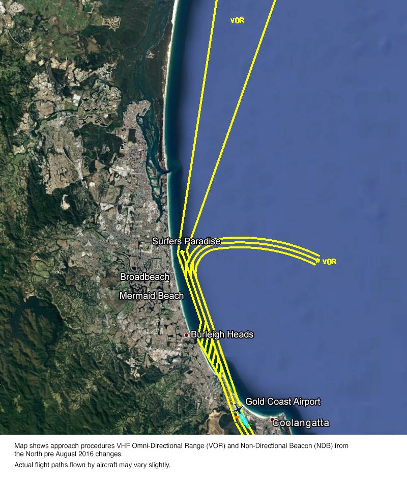
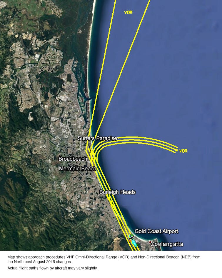
Gold Coast navigation modernisation
A series of flight path changes came into effect at the Gold Coast Airport in August 2016. These changes are part of a nationwide Navigation Modernisation Program.
The changes are in response to the Civil Aviation Safety Authority (CASA) and International Civil Aviation Organisation (ICAO) requirements for increased runway alignment and for all aircraft operating under Instrument Flight Rules to be able to navigate using satellite-assisted means when flying in Australian airspace.
CASA and ICAO require Airservices to introduce these changes to ensure the highest levels of safety assurance is achieved in accordance with international practices and requirements.
What
Continue readingThis page provides a summary of the flight path and airspace changes we implemented in 2016.
-
Gold Coast southern departures reinstatement
Airservices proactively works with Gold Coast Airport and the community to minimise noise impacts where possible. To reduce the impact of aircraft noise on local residents and at the request of the community, Airservices trialled a change to a flight path for southern departures from Gold Coast Airport.
The trial flight path change commenced on 8 January 2015 for southern departures on Runway 14 and continued for 12 months, to cover normal seasonal patterns of runway use and allow the community the opportunity to provide feedback.
Airservices considers the trial did not achieve the intended noise reductions. The trial alsoContinue reading
This page provides a summary of the flight path and airspace changes we implemented in 2016.
-
Melbourne Smart Tracking
In November 2016 Airservices implemented a new international standard Smart Tracking procedure on Runway 16 to improve safety, noise and emission outcomes for Melbourne Airport.
What did not change?
Most aircraft movements around Melbourne Airport were unaffected.
When Runway 16 is in use for landing, aircraft generally arrive using the Instrument Landing System (ILS) which is runway aligned from approximately 15km to the north of the airport.
In good weather conditions, aircraft arriving from the west or south may also use a visual approach. This approach aligns with the runway closer to the airport at approximately 10km to the northContinue reading
This page provides a summary of the flight path and airspace changes we implemented in 2016.