Sunshine Coast Airport Airspace Changes Runway 13/31
Sunshine Coast Council led the Sunshine Coast Airport Expansion Project and has delivered the new runway (Runway 13/31). The new runway and associated flight paths became operational on 14 June 2020.
These flight paths will change the way aircraft operate as they arrive and depart from Sunshine Coast Airport.
For more information on flight paths and aircraft operations, view our Fact Sheets here. Following community feedback, we have included both the minimum and average heights for departures, as heights for departures can vary depending on aircraft type. Heights for arriving aircraft continue to be presented as minimum heights, as heights for arrivals are less varied.
We have provided FAQs here.
Where can I access more information?
For information on current aircraft movements and flight paths, historical runway utilisation or monthly complaint reports for the Sunshine Coast, visit the Airservices website here (external site).
For information on aircraft noise, visit the Aircraft Noise Information Tool on the Sunshine Coast Airport website here (external site).
For more information on the Sunshine Coast Airport Expansion Project, visit the Sunshine Coast Council website here (external site).
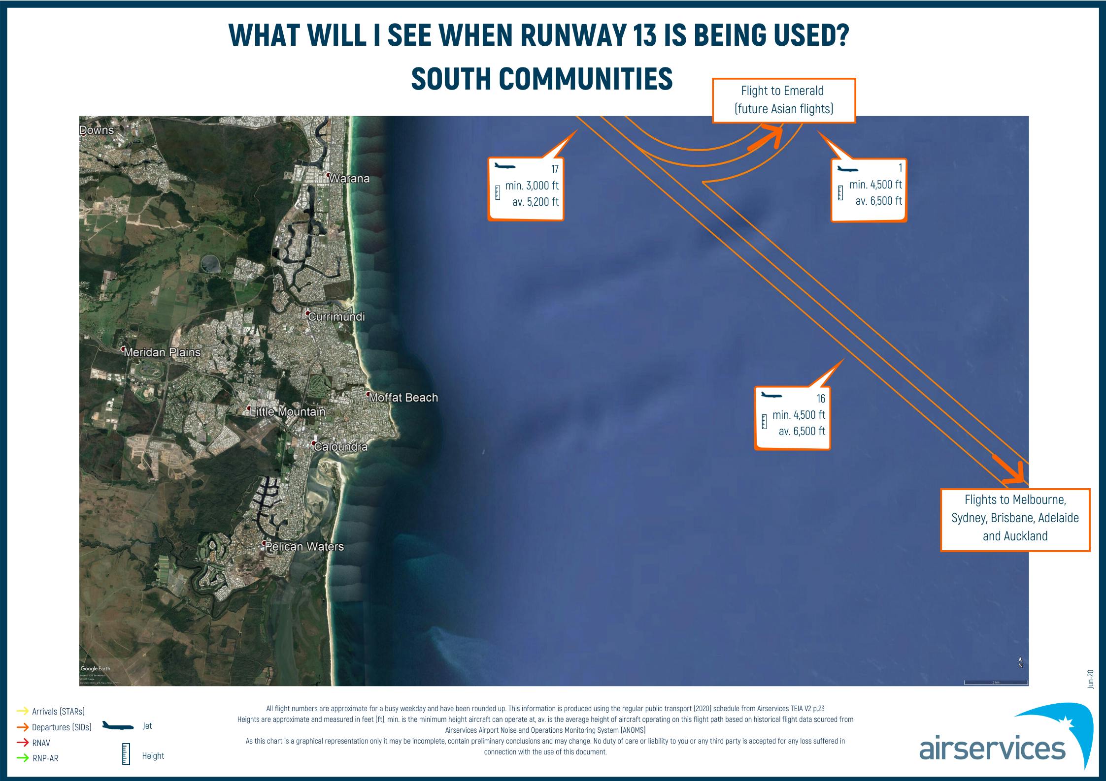
Flight paths - RWY 13 Operation
This map shows the flight paths used when runway 13 is in operation (aircraft arriving over land and departing over the ocean).
You can search for your address relative to the flight paths by using the search tool located on the top right corner of the map.
STARs (Arrivals) - Pink
Approache procedures - Green
Departures - Blue
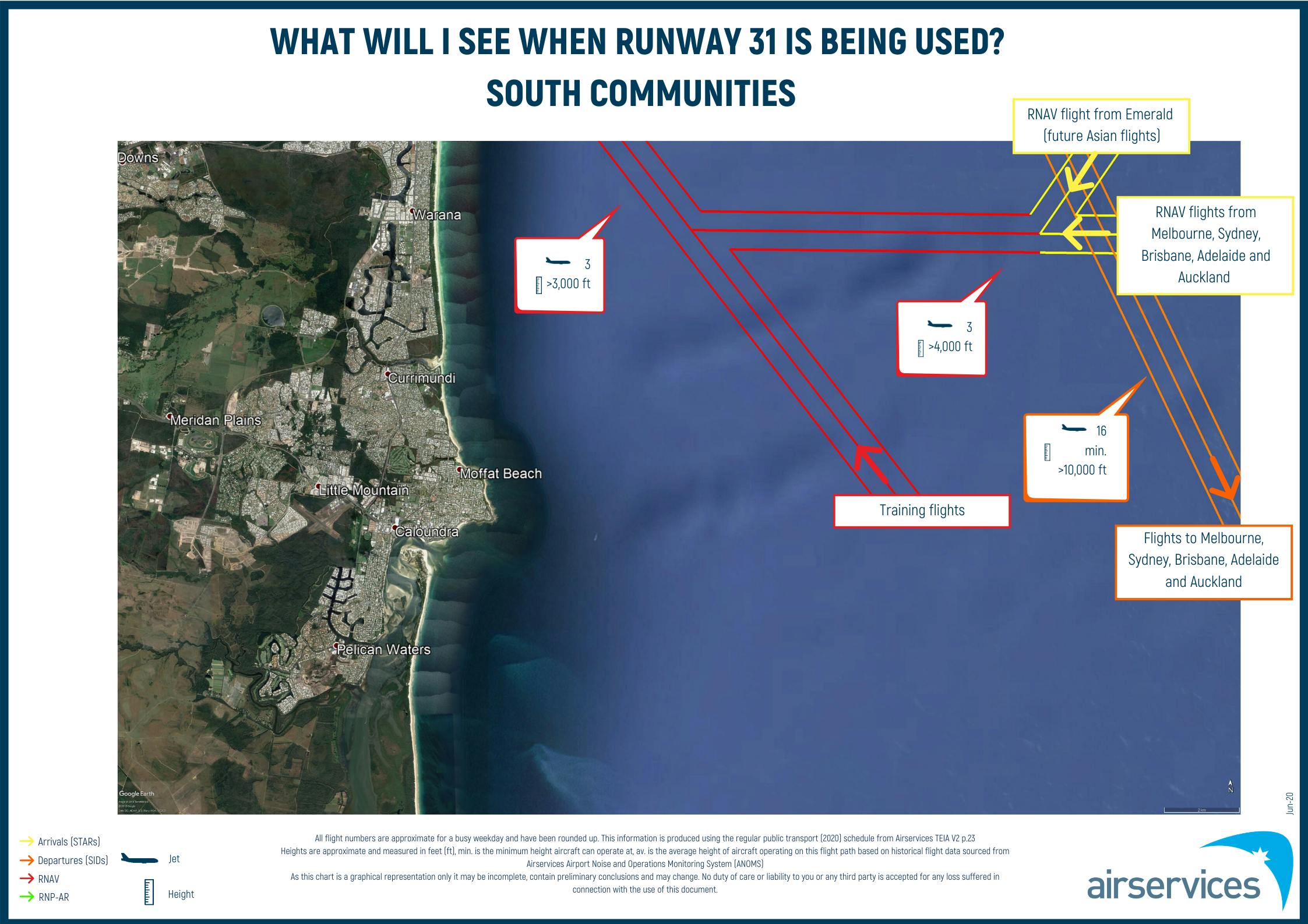
Flight paths - RWY 31 Operation
This map shows the flight paths used when runway 31 is in operation (aircraft arriving over the ocean and departing over land).
You can search for your address relative to the flight paths by using the search tool located on the top right corner of the map.
STARs (Arrivals) - Pink
Approache procedures - Green
Departures - Blue
Flight paths - current
Current Sunshine Coast Airport flight paths with waypoints.
You can search for your address relative to the flight paths by using the search tool located on the top right corner of the map.
STARs (Arrivals) - Pink
Approache procedures - Green
Departures - Blue
Waypoints - Red
Aircraft tracking (2022) - Arrivals
This map contains aircraft tracking for RWY 13 arrivals (over land) in 2022, 1 January - 31 December 2022.
You can search for your address relative to the flight tracks by using the search tool located on the top right corner of the map.
RNP (long approach) - Cream tracks
RNP-AR (short approach) - White tracks
Aircraft tracking for RWY 31 arrivals and RWY 13 departures (over ocean / Mudjimba) has not been captured as every flight operates over the community due to the proximity to the runway end.
Aircraft tracking (2022) - Departures
This map contains aircraft tracking for RWY 31 departures (over land) in 2022, 1 January - 31 December 2022.
You can search for your address relative to the flight tracks by using the search tool located on the top right corner of the map.
SID MOOLO (South) - Green tracks
SID TAPET (North) - Orange tracks
Aircraft tracking for RWY 31 arrivals and RWY 13 departures (over ocean / Mudjimba) has not been captured as every flight operates over the community due to the proximity to the runway end.