Sunshine Coast Airport Airspace Changes Runway 13/31
Airservices is progressing the recommended actions identified through the Post Implementation Review (PIR).
A new project page has been created on Engage Airservices to provide ongoing updates on the delivery of these actions.
Sunshine Coast Council led the Sunshine Coast Airport Expansion Project and has delivered the new runway (Runway 13/31). The new runway and associated flight paths became operational on 14 June 2020.
These flight paths will change the way aircraft operate as they arrive and depart from Sunshine Coast Airport.
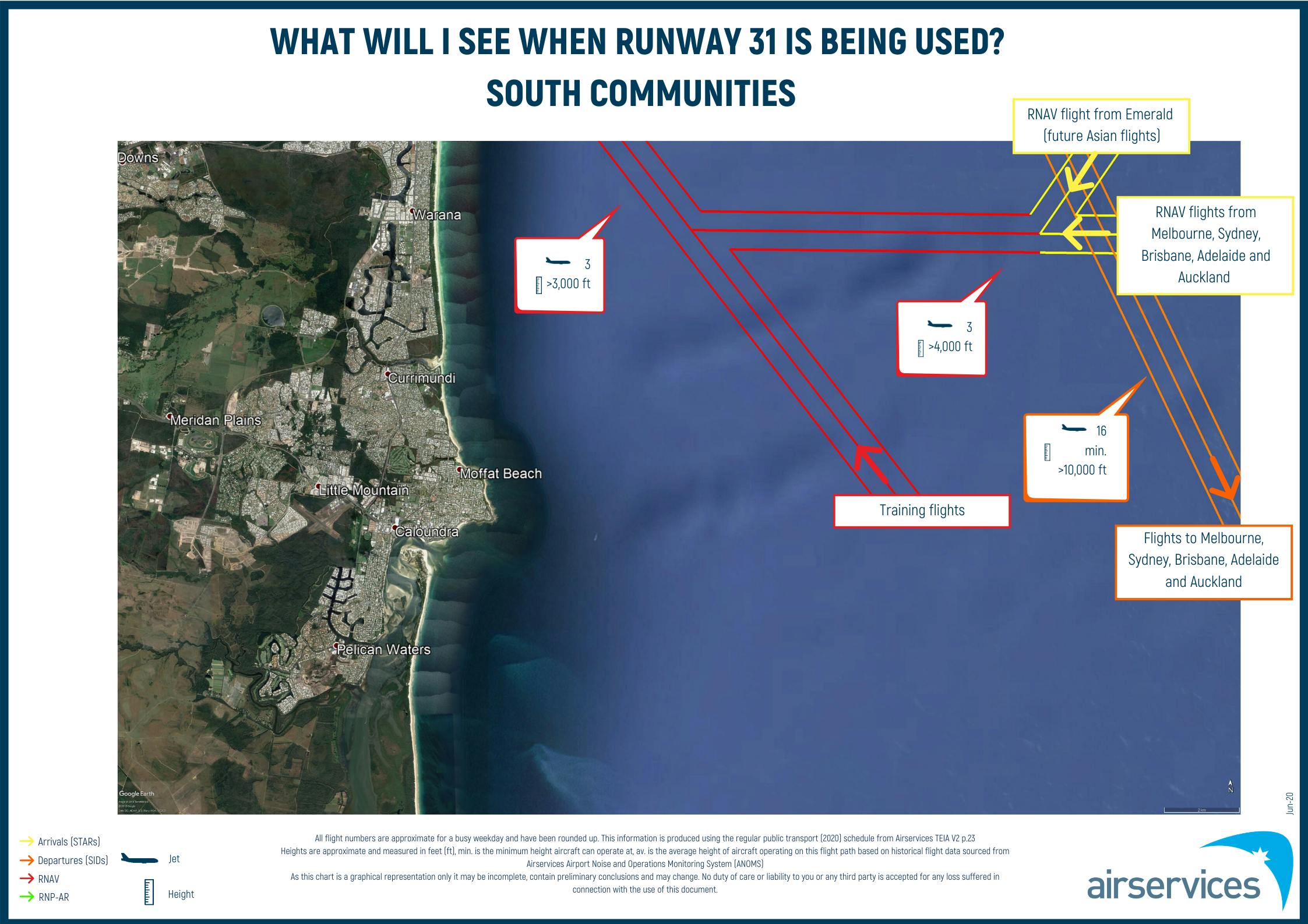
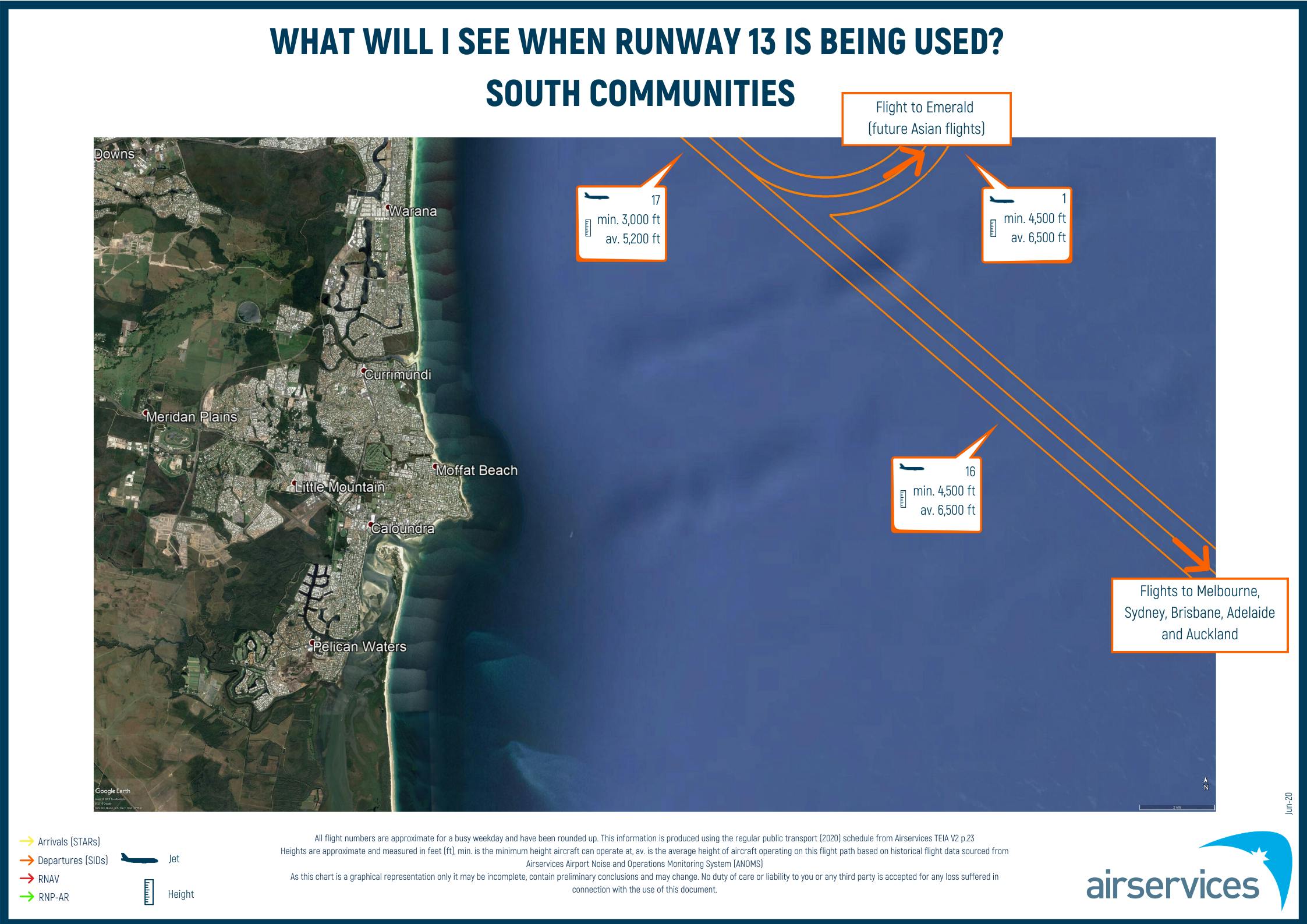
For more information on flight paths and aircraft operations, view our Fact Sheets here. Following community feedback, we have included both the minimum and average heights for departures, as heights for departures can vary depending on aircraft type. Heights for arriving aircraft continue to be presented as minimum heights, as heights for arrivals are less varied.
We have provided FAQs here.
Where can I access more information?
For information on current aircraft movements and flight paths, historical runway utilisation or monthly complaint reports for the Sunshine Coast, visit the Airservices website here (external site).
For information on aircraft noise, visit the Aircraft Noise Information Tool on the Sunshine Coast Airport website here (external site).
For more information on the Sunshine Coast Airport Expansion Project, visit the Sunshine Coast Council website here (external site).

Resources
-
 PIR report
-
 Sunshine Coast community workshop (15/10/2022) presentation (2.78 MB) (pdf)
-
PIR Terms of Reference and Community Engagement Plan
-
Noise modelling and Noise Abatement Procedures
-
Short-term Noise Monitoring
-
PIR Community Meeting Resources
-
Presentation - Sunshine Coast CIS - 18-11-2021 (3.91 MB) (pdf)
Videos
-
Video recording of the Webex meeting on Noise Modelling, Noise Monitoring and Noise Abatement Procedures.